The Lowmarch
A fictional lowland of farms, canals and walled cities, 64 × 48 km, where three armies fight one long war.
The war takes place in the Lowmarch, a fictional lowland modelled on the Western Front of northern France and Belgium. It is flat farmland, canals, a long chalk ridge, forests, walled cities and many small villages. Brennhof, Velde, Kessel junction and the city of Altwasser are all places on it. Most of it you will only ever see through recon, from far above.
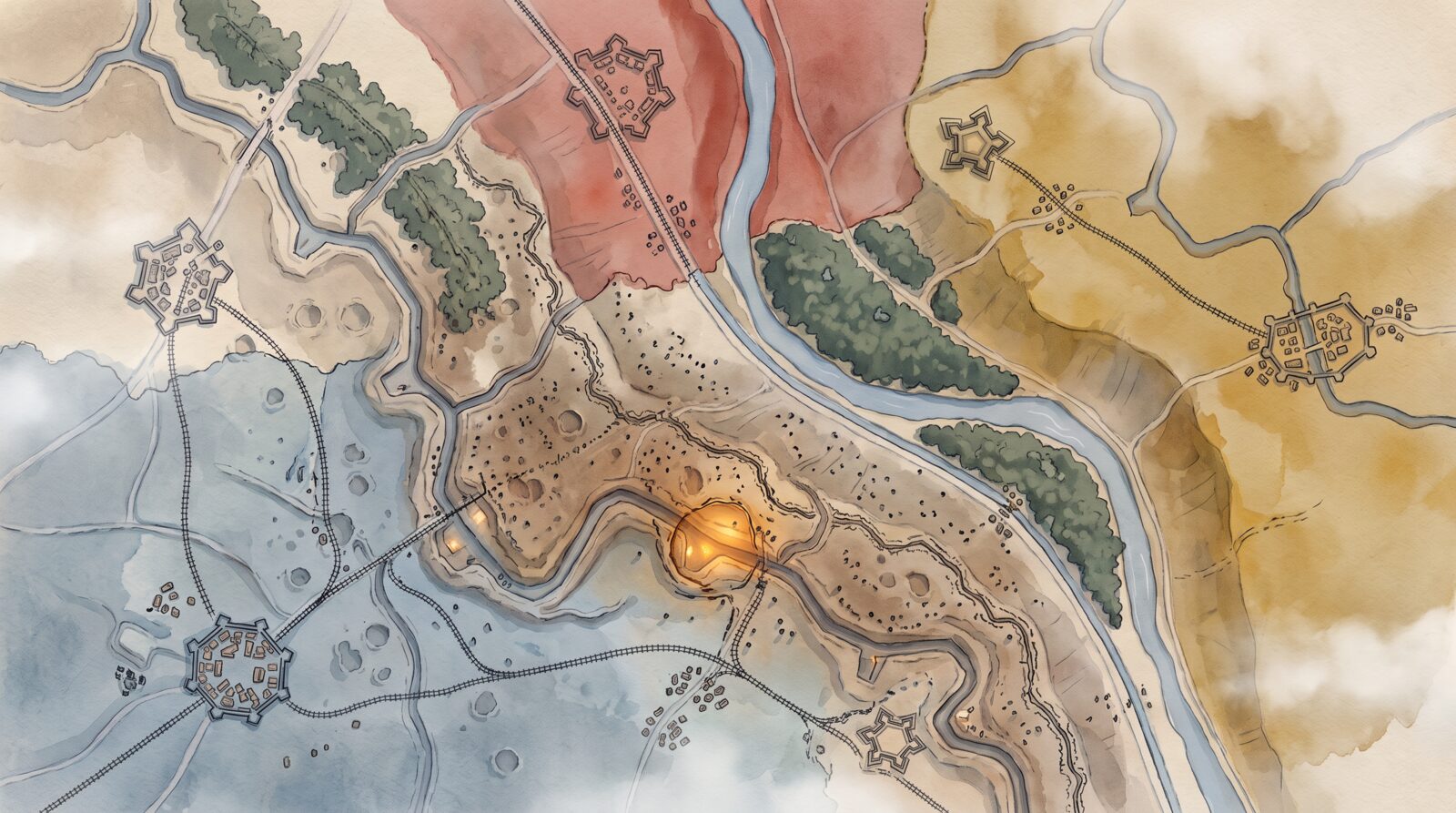
The shape of the land
| Property | Value |
|---|---|
| Size | 64 × 48 km |
| Armies | Hearthguard (south-west), Rustcoats (north), Mustard Company (east) |
| Home territories | Each army's hinterland behind a fixed last line of forts; never captured |
| Contested belt | A band 12–20 km wide between the homes, where all fronts move |
| Starting fronts | Drawn through the belt at the start of each war |
| Rails | 3–4 main lines per army from its cities, junctions in the belt, sidings every 1–2 km |
Static borders, moving fronts
The borders between the home territories and the belt never move. Each home has a fortified city behind its last line, and no home is ever captured, so the war cannot be won by overrunning one. Inside the belt, the fronts move with the fighting. See The three armies and The hot zone.
Places that matter
These places are fixed, and operations and fighting gather around them.
| Place | About how many | Why they matter |
|---|---|---|
| Cities | 3 home cities, 4 in the belt | Rail hubs and story anchors; the belt cities are major prizes |
| Towns and villages | 60 | Supply, story letters, ruins that persist |
| Forts | 12, on the last lines and in the belt | Heavy defence; artillery targets |
| Rail junctions and bridges | 25 | Supply and movement; prime targets |
| Ridges and hills | 1 long ridge, 10 hills | Observation: whoever holds them sees further |
| Depots and airfields | 20 | Supply and recon planes |
| Canal and river crossings | 15 | Natural front lines |
See The rail network, Supply and Recon: spotters, balloons and planes.
Drawn by hand, detailed by the game
The Lowmarch is drawn by hand at large scale and filled in by the game. Borders, cities, rivers, ridges, rail lines and points of interest are fixed, and the same for every player. Fields, hedges, trees, village layouts and the fine shape of the ground are generated.
The look owes a lot to Paul Nash's paintings of the Western Front, especially We Are Making a New World (1918), for the dawn palette and the shapes of cratered, mounded ground. It also owes a lot to First World War trench maps and aerial photographs: the battlefield should read like a hand-coloured trench map. See Art direction: watercolour war, clay gun.
How a war ends
A war ends when one army holds a set share of the belt's key points for long enough. Then a new war begins from the same starting fronts. In the shared war, that works much like a campaign in Foxhole or Helldivers. See The shared war and One continuous war.